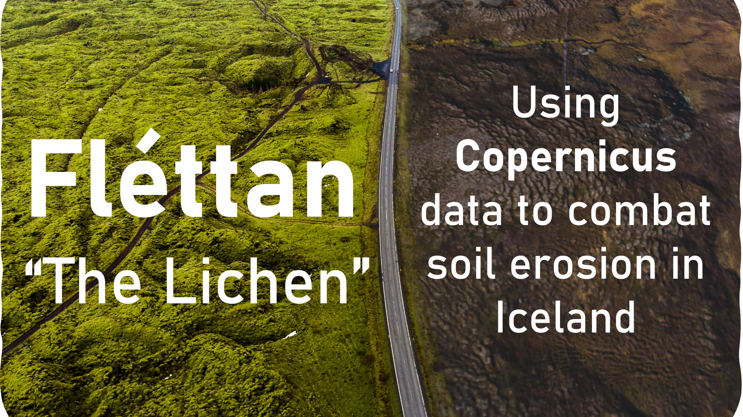
Fléttan
Exhibitors
Information
Our team:
Roman Pechenkin: Software development
Christina Rodriguez: Research and businessdevelopment
Marco Pizzolato: GISmapping
Cécile Chauvat: Communication and research
Daniel Fernandes: Algorithm development and physic
We are Fléttan, a small team of scientists and students who won the 2nd Cassini Hackathon last November.We are participating in the Cassini mentoring program and are planning on launching a startup to take our idea from project to reality.
Fléttan means“The lichen” in Icelandic, and it is the first organism to grow on severely eroded soils. It is also a symbiotic organism that, to us, represents collaboration to overcome obstacles. Icelandic soils can contain up to 80% carbon. Because of climate change, agriculture, and harsh weather, erosion is breaking down the top layer of this unique soil. When this happens, the carbon is released into the air, and in turn contributes to climate change. Eroded soils lose their ability to sustain life, and lands turn into lifeless deserts. This also happens all throughout the Arctic, where climate change is affecting nature faster than in the rest of the world.
There are ways to slow this process down, for example revegetating areas, but first we have to know which areas to focus on before the damage is too extensive. This is where our project, Soil Erosion Evaluation andDetection (SEED)comes in.
We are creating a tool that uses Copernicus data, as the Sentinel 2 satellites have a Multi-Spectral Instrument (MSI) with 13 spectral bands that range from the visible range to the shortwave infrared (SWIR). Bands come in variable resolutions from 10 to 60 meters and their wave length is determined based on specific purposes. Based on this data will be able to calculate various vegetation and soil indices such as NDVI, DSWI, NDSI MSVI2, etc. After this, we use a combination of spectral indices, statistics analysis, and AI prediction model to:
•Calculate a number of indices that describe soil
•Remotely map the extent of Icelandic soil erosion
•Assess the severity of erosion in affected areas
•Predict the areas where erosion is likely to happen or worsen
SEED will take the form of a map which will be a precise and easy to use tool providing all necessary information in one place. This solution is not available on the market in Iceland. Upon searching for soil erosion maps in other countries we have only found images and the occasional zoomable map based on observational data and no physical models. We have, however, found published research that brings ideas similar to ours into reality, thus proving the viability of the project. In fact, the advancement in satellite remote sensing technology has revolutionized the approaches to monitoring the Earth’s surface, as showcased by recent research such as a study from the Czech Research Institute for Soil and Water Conservation2and the use of Geographic Information Systems (GIS) in Canada. These published results employ multi-resolution approaches to soil erosion risk mapping but used only rainfall and vegetation cover as indicators. Our statistical analysis of satellite images will be based on published research from a Cameroon-based team that falls short of calculating soil erosion risk, because of the lack of consideration of urban areas and the imbalance between the number of vegetation index and the number of soil index" which could be fixed through "a readjustment that will allow integrating new parameters including climatic effects like the temperature of the surface, precipitations, albedo, or evapotranspiration". These are limitations that we aim to surpass. We are building a cloud-based solution using various big data and image processing libraries. By employing machine learning techniques, it will be easy to analyze trends in soil erosion and make predictions based on past data. To train our machine learning algorithm, we are collaborating with the Soil Conservation Service of Iceland, and they are providing us with ground-truth data from the last ten years. They are also our first client; this would enable them to:
•Reduce costs and time necessary to collect data
•Not be limited by site accessibility
•Assess areas much more regularly
•Learn more about the effects of climate change on soils in the long term
Once our proof of concept is engineered, we will be able to expand and apply the same idea to other countries.Some regions that come to mind include Greenland, Siberian and Alaska, where several regions are difficult to reach and vulnerable to soil erosion.